Showing posts with label Historical Documents. Show all posts

Tuesday, May 26, 2026

C.C. Robin

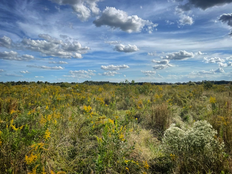
​“Crossing the wide prairie, strewn with flowers, whose stems raise them to the height of the horse on which the traveler is riding, surprise follows surprise in this varied vegetation. One rides suddenly upon herds of cattle, who raise their haughty heads above the grass as one rapidly approaches.” (Robin (2000)).


Monday, May 25, 2026

Meche-Wilkes Mound


The Meche-Wilkes Mound, is located near Arnaudville on the periphery of the Atchafalaya Basin on the edge of the Pleistocene terrace. This site has been protected by the landowner and is relatively undisturbed. Gibson conducted excavations at the Meche-Wilkes Mound in 1990. The site contains deposits dating to the Poverty Point, Tchefuncte, Baytown, Plaquemine, and historic periods (Lousiana State Site Form).


The Anthropology department came across an historical discovery in '89, revealing some history of Acadiana. Archaeological excavations at Meche-Wilkes mound near Grand Coteau by USL archaeology students confirmed the earthen mounds were built by the Acadiana's native people during the first pre-Christian millennium. These mounds were used for cooking during the era. Lonnie Utley USL's L'Acadien 1989

Sunday, May 24, 2026

On the Olivier Site and Meche-Wilkes Mound


Jon L Gibson 
The Ancient Mounds of Poverty Point Place


CULTURAL RESOURCES SURVEY OF FOUR DISPOSAL AREAS ALONG THE VERMILION RIVER LAFAYETTE PARISH, LOUISIANA

Cultural Resources Survey of Four Disposal Areas Along the Vermilion River Lafayette Parish


Cultural Resources Survey of Four Disposal Areas 
Along the Vermilion River Lafayette Parish:
US Army Corps of Engineers

"USL continued to excavate selected sites in the general area. A. Frank Servello conducted test excavations in the Meche-Wilkes Mound (16SL18) on Coulee de Marks between Grand Coteau and Arnaudville in the late 1970s. Coulee de Marks is a tributary of Bayou Fusilier, which is the eastern head branch of the Vermilion River. Gibson continued excavations there in 1989-1991. This site has a low conical mound filled with fragments of Poverty Point objects as well as fiber-tempered and untempered Tchefuncte-like pottery, surrounded by a midden containing untempered Tchefuncte-like pottery (Gibson 1990a:109-lll, 117-118, Tables 26-27). The fiber-tempered pottery is similar to that from the Ruth Canal site, 20km to the south, and these sites, along with a few others bearing fiber-tempered wares in the locality, probably represent a very narrow time interval around 1000 B.C."


"Despite its compact size, Beau Rivage (near the confluence of Bayou Tortue and Vermillion River) had large quantities of exotic rocks—thousands of pieces and possibly hundreds of kilograms. Exotics make up over a third of all lithic materials in the available collection (Gibson 1976a:Table 20). There are at least nine other sites within a 25km radius of Beau Rivage that have exotic materials—materials other than novaculite and quartz crystals, which are not really exclusive Poverty Point commodities (Gibson 1991b). The Olivier site (16SL12), near the junction of Coulee de Marks and Bayou Fusilier, is the most notable of these other sites (Gibson 1976a:38-39). But none of these sites comes close to matching Beau Rivage in absolute quantities, although Olivier might come close in terms of relative quantities. The point to be made here is that Beau Rivage is not an isolated component. For 25km above and below Beau Rivage along the Coteau Ridge and flanking Vermilion swamp are other presumably coeval sites bearing foreign lithic materials. We suspect Beau Rivage was the local supplier. But where did Beau Rivage get the rocks? In an earlier analysis, Gibson claimed that they came directly from the Poverty Point site, 280km to the north {Gibson 1979). Gibson thought they were first delivered to Poverty Point, where they were rendered into tool blanks before they were then shipped on to distant consumers, like Beau Rivage. Now, after more than a decade of recent excavation at Poverty Point have failed to find either the unaltered bulk materials or the primary chipping residue showing that preshaping actually took place at Poverty Point, we are not as certain. Initial shaping of tool blanks for trade now seems more likely to have been carried out at the rock outcrops or deposits themselves. Poverty Point still seems to be the most likely source of the blanks and nodules that got to Beau Rivage, but search for intervening distributors continues."


"...Several San Patrice points were found at Meche-Wilkes Mound, on Coulee de Marks near its junction with Bayou Fusilier"


"Additional Archaic components occur upstream and downstream from Lafayette. Downstream some eight kilometers below the Vermilion River gap is a cluster of sites (16VM7, 16VM17 and 16VM23) near the mouths of Anslem Coulee and Coulee He des Cannes. One of these (16VM23) produced several projectile points (including Evans, Ensor, Benton, and others), point fragments, drills and drill fragments, chipped adzes and gouges and fragments, boatstone fragments, and tubular and barrel-shaped stone beads (Gibson 1976a:Table 23, Figure 10). However, only a handful of flakes was recovered, totally insufficient to complement the number of finished tools on the site. The assemblage is unusual enough to lead us to suspect that it might be functionally specialized, perhaps even ceremonial. Upstream where the river parallels the Coteau Ridge are other Archaic components, and on the low Prairie des Femmes terrace, where flanked by Coulee de Marks between Grand Coteau and Arnaudville, is the oldest Archaic component known in the Vermilion locality. The Coulee de Marks site (16SL48) produced Early Archaic point types, Keithville and Cache River, as well as point fragments and preforms, small flake end scrapers, and chipping residue (Gibson 1990a:Table 24). There was substantial Archaic activity on or near the Vermilion River, and it seems to have spanned much of the long Archaic interval. But precisely when and what forms it took are unknown. We have only the most general perceptions of the interval, but they are sufficient to show that the locality continued to be a favorite spot for native groups. Having a long-standing sizeable population in a place with easy access to the interconnected waterways in the Lower Mississippi Valley was probably a prerequisite for entering into an era of commercial exchange, which characterized the ensuing period."


Mississippi Meander and the Teche Ridge


Back Field Habitation

This field where we settled over 20 years ago never seemed physically special but there was a presence here. It's a leached sweet potato field out in the center of the open prairie, near the oxbow woods as I called them. It was not on the bayou. There was no important earth works, inclines or mounds as there are in other places in the prairie. The neighbors have found buckets full of artifacts: spear points, grind stones and stone tools. I know of the three prehistoric sites in the prairie including the Meche-Wilkes Mound and the Olivier site, but they are a half mile away from here. For years I have walked looking at the ground and feeling the subtle undulations, but never suspecting that there had ever been anything here besides farmland and pasture. 

I had found ceramics. Years ago we surmised they were spread to aerate the soil for farming. Maybe they were spread in a flood event. Either seemed plausible. Maybe more plausible than there being a homestead in the exact spot that we chose, ten acres back off a gravel road, near haphazardly and only because of its proximity to a lone cypress in the tree line. 

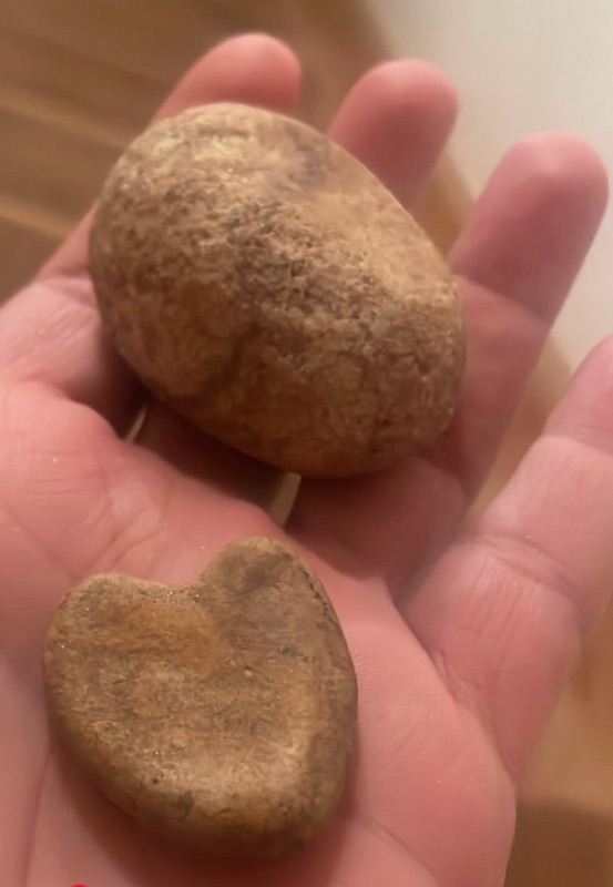
I found delicate things in the earth though, the curl of a blue and white fleur de lis, doll arms and legs, pieces of plates, bricks, thick crocks and milk glass. Still, with our position back here I could hardly imagine there had been habitation so far off of the dirt road. There were no paths or racourcis that I knew of crossing the prairie. Still I got the message that there was memory back here, both recent and ancient. Then one day in the carrot patch I found a real rock in the shape of a perfect heart. 

In the east yard we plowed some rows to plant coton jaune, native brown cotton. After it rained I would inspect the exposed ground along the rows. I found another stone, but this time it seemed to be a hand tool for grinding or hitting. There was a worn tip and slight indentions along the sides that fit my thumb and fingers perfectly. I marveled at its weight and ergonomic feeling in my hand. 


Sometimes when I walk the field, or even recently when I turned over a little dirt out there, I still find white ceramics and strange rocks, sometimes blue glass that looks knapped at the edges. The more I let the prairie grow, the more old plants appear that tell of use. The more I dig, the more is unearthed. I tell myself if there was a home place here it would have been in my east back field according to the evidence, but it still doesn't make sense. Not to mention how ironic it would be to have built in the same place. On the other hand, it does makes sense to me, because there is a tangible presence back here that is pleased to be remembered.

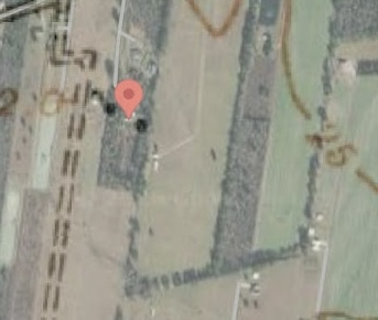
Recently I was going through some old topography maps online of the area and something caught my eye: a few black squares denoting domicile on the 1940 topographic map, far back in the prairie. Intrigued, I doubted it was far enough to be my field. But I used the overlay tool to match up the road and other landmarks with satellite maps, and discovered to my surprise that they were located at the end of my driveway, flanking both sides of my house, in the exact place where I find the ceramics in the backfield. 


Saturday, September 14, 2024

La Pointe Claire

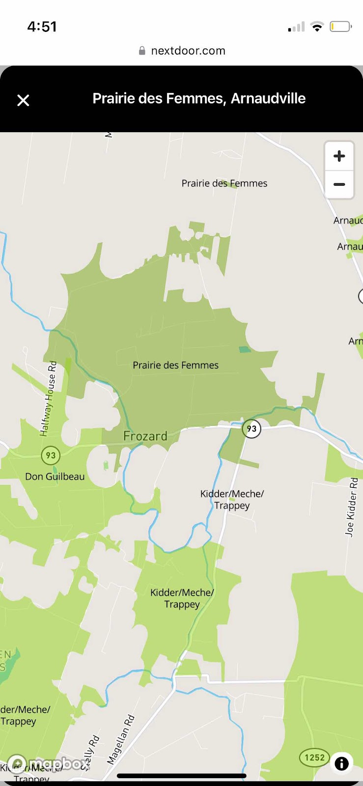
General belief is that Pointe Claire was a clear, open grassland in the cove directly east and bordering la Prairie des Femmes. To arrive at the Pointe Claire from the Prairie des Femmes cross the Coulee des Marks at Marks Bridge, and travel north on Jules LaGrange until it intersects Hwy 347. To the west one will intersect Leonville and the Bayou TĆŖche, and to the east toward Arnaudville is la Pointe Claire. 

Tuesday, September 3, 2024

Prairie des Femmes Origin Stories

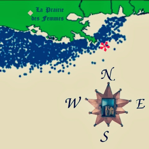
 Prairie des Femmes

Coming to the Prairie and Staying


When I arrived here in 2004 my neighbors called the area Leonville or Anaudville, for the bayou villages to the extreme north and east of the prairie, respectively. There was no marker, no sign and no online presence of the pre-colonial Prairie des Femmes, save for topographical maps where she was marked at Coulee des Marks bridge, and two inquisitive articles published in the Teche News by Mr. Floyd Knott.  If I am completely honest, there was also a wood routed sign that said Prairie des Femmes on a neighbor's chicken coop up by the Bayou Bourbeux that I spied through the trees.  

 The romance of the name seemed to me incongruent with the general knowledge of her existence. I was from another village, called la Ville Platte further to the north in Evangeline Parish. Around la Ville we had many other lieu-dits, les petits places, where we visited and that were part of the common vernacular of life. There was Chataignier, of course, and halfway there, la Pointe Bleue and L'anse Aux Pailles. We frequented Faubourg, Tate Cove, L'anse des Belaire, Vidrine, Redell, and L'anse Grise beyond. I was familiar with these places, yet just 20 minutes from my hometown, I had moved to this women's place whose history and terrain felt remote and largely unexplored. 

Louisiana French connected me more closely to my state, her French and native memory and my place within it all. I began to gather maps, records and historical research as well as personal stories about how the prairie was named: her origin stories. It was clear that these are all native lands and la Prairie des Femmes is a reminder. The neighbors reported the prairie was a place where women and children were found living when the men left for one reason or another. If I asked, they pointed me to the Civil War as origin of the mens' absence, but the records I found suggested that the prairie had a longer memory.

  One local said he believed that the girls outnumbered the boys at the house dances, and that the Stelly, Marks and Quebedaux families produced them. Another story says that in Louisiana's historic flood of 1927 woman and children were sent here from neighboring communities because of its relative safety. (The prairie is at some elevation, but I am still not sure what parts of her flooded in '27) Another tale sites the area as a place where the widows of the soldiers of the Civil War settled to live the remainder of their lives in peace. Some say the women of the area refuged back here when the skirmishes along the bayou Bourbeaux, at Grand Coteau and Chretien Point made it unsafe for the women and children in town. Some reported that the women were left here to farm while the men fought for the Civil War, WW1 or WW2. Some locals even pronounce it "prairie des fermes" and will connect the name to the women farming, or the fact that there are still many agricultural fields here. Another neighbor gave me the rough coordinates of a "fort" that existed here for the protection of the women. 

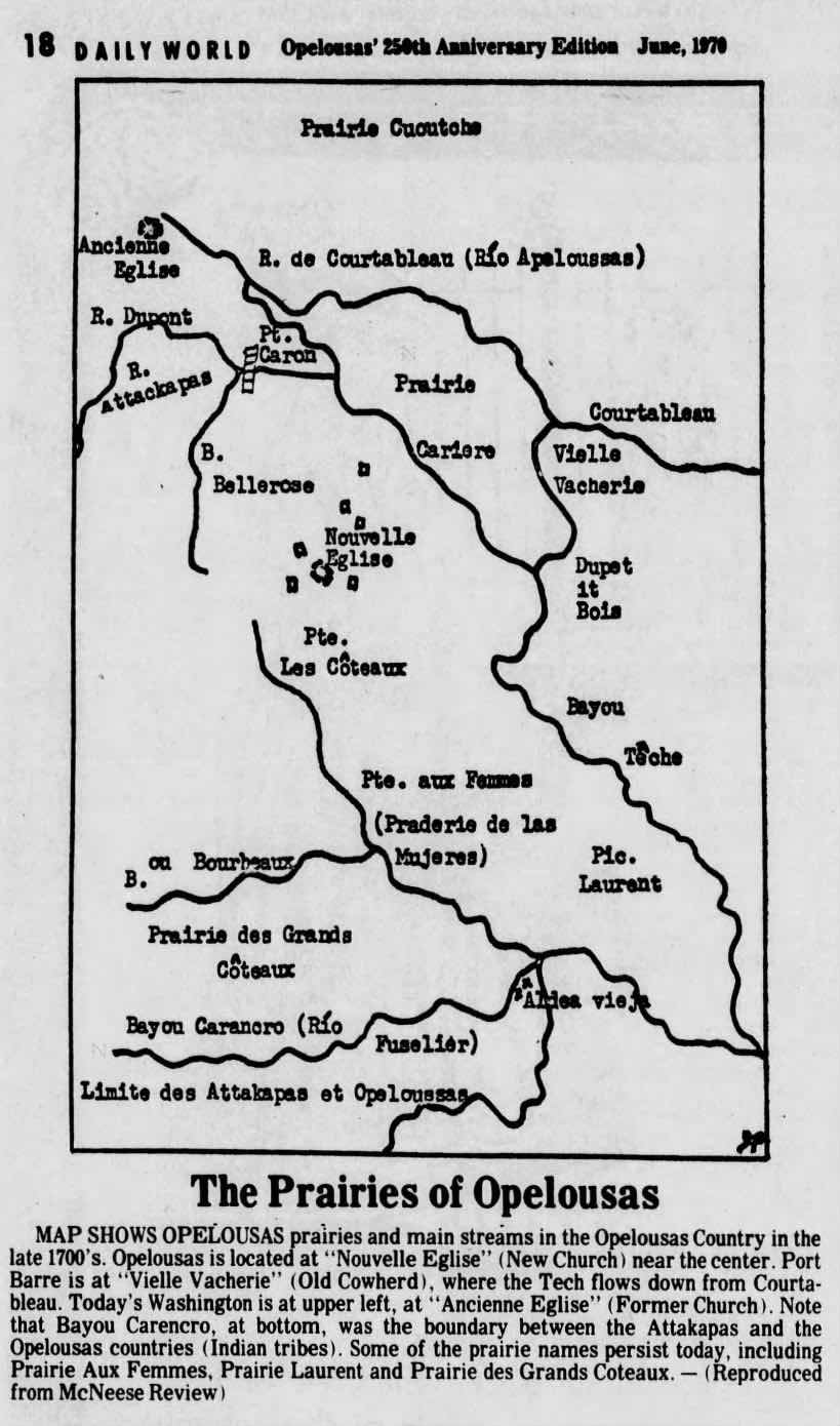
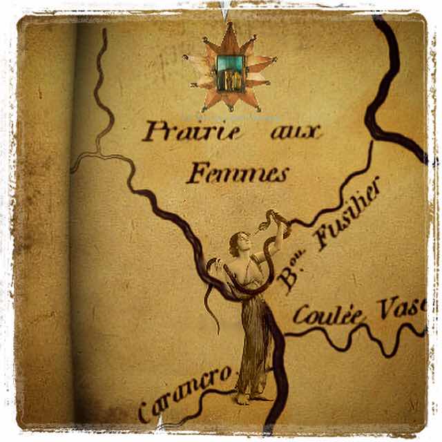
The most likely story of the origin of the name Prairie des Femmes is the native one, of course. The prairie is a pre-colonial, native place, located at the historical boundary of the Attakapas-Iskak and Opelousas tribal lands. It is named for bands of Ishak and earlier Tchefuncte people who used the prairie was a backwater refuge for their women and children away from the major rivers and bayous of the time. Prairie des/aux Femmes appears on detailed maps of the region as early as 1806. Because of the prairie's central and borderland location, there was much native traffic and infrastructure here. 

Legend has that the area was a high land, a safe zone near the bayous where women lived together while the men hunted or warred. There are a few versions of this story. One is that the male natives inhabiting the prairie moved after a hunt, as was custom. A few of the women stayed at the camp, being too comfortable to move.  Another version says that the prairie was used in ancient times as an off-river refuge for the women that protected them until the men came back. The men were always leaving for war or hunting in the stories. Another says that the male hunters, or bears, went on a hunt leaving their wives on the prairie. The women left there were discovered by the French Creoles and Acadians (Michel Cormier) who settled the area and called it la Prairie aux Femmes. (In Louisiana vernacular the contraction des and aux ((of/to/at the)) are both used when showing possession, aux being older. I have found both des and aux on maps of the prairie) I am often curious if the name is a direct translation of the indigenous name for the place, and if so what the old name was. One of my neighbors had his explanation, offering "that's an old name, yeah." After 20 years of research, this seems to be the most accurate detail of all. 


Tuesday, May 5, 2020

Prairie des Femmes and other Locales

Via Mike Leblanc: 

10.0 Adjacent Angles, Prairies and Points

There is yet other places, known as Prairie Laurent, Prairie des Femme, and Point Clair. Each has its distinctive character based on the stories upon which its sense of place was created.

10.1 Prairie Laurant

Prairie Laurant is also known as Prairie des Mulates, that is literally, Prairie of Mulattoes. Mulatto is in French, is called a mulĆ¢tre for men and mulĆ¢tresse for women.[1] Perhaps one of the most well known residents of La Prairie Basse is Clifton Chenier, and his brother, Cleveland, both proud black men, who are among the founders of Zydeco music. Reflecting their racial heterogeneity, their music is a hybridization of Blues, Jazz, Cajun, Country and Western, and Rhythm and Blues, played with an accordion, that quintessential French instrument, and a washboard, a folk instrument used to create African rhythms.

10.2 Prairie des Femmes

To south of Prairie Laurent, a place is still called La Prairie des Femmes (or literally Prairie of Women)If you ask an inhabitant of that place (who are mostly Cajuns) what is the origin of that place name, you will be told that all of the men were killed while on a hunting expedition in time long forgotten or during a war, particularly World War I or World War II. However, the earliest maps of the area created by Spanish indicate that the place was called the same name so the meaning has been placed mouth to ear for some 300 years, its true meaning lost to the ghosts of another time.

To the east of La Prairie des Femmes is a place called Pointe Claire, a pasture used in the spring to herd cattle upon the grasslands. As late as the 1960’s, the cattle were driven by horseback from land laid fallow in the winter months to these nearby pastures for their spring grass. These lands were first discovered by that early band of Africans who hunted deer to extinction and were later to inter-marry with Acadians who herded cattle upon those lands.

10.3 McVeigh Plantation

To the south of La Prairie Basse lies the McVeigh plantation, a place of level lands upon a prairie cleared of its high grass and where slavery was practiced in the 19th Century and later where share cropping also enslaved Afro-American, Creoles and Cajuns in a labor system meant to drive their laborers and their families into penury and serfdom meant to tie them to land as well as to enrich their land owners. Today, McVeigh Road runs down the middle of this plantation and is bordered on both sides by cane fields.

McVeigh Road comes to an end at its intersection with Louisiana Highway 31, which parallels Bayou Teche. Alongside of highway is a narrow strip of land upon, which was too narrow to farm and which was the location of the sharecropper shacks used in the early 20th Century. While the descendants of Ton Ton were free persons of color and devote Catholics, the descendants of the slaves working on the McVeigh plantation were lively Protestants, practicing within the Baptist Convention.

Information via  Mike Leblanc