Showing posts with label Meche-Wilkes Mound. Show all posts

Sunday, June 21, 2026

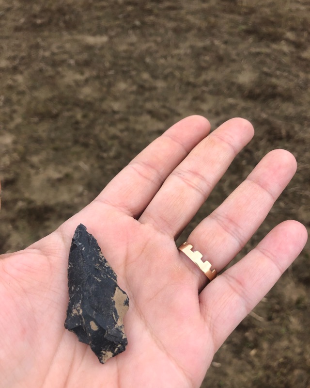
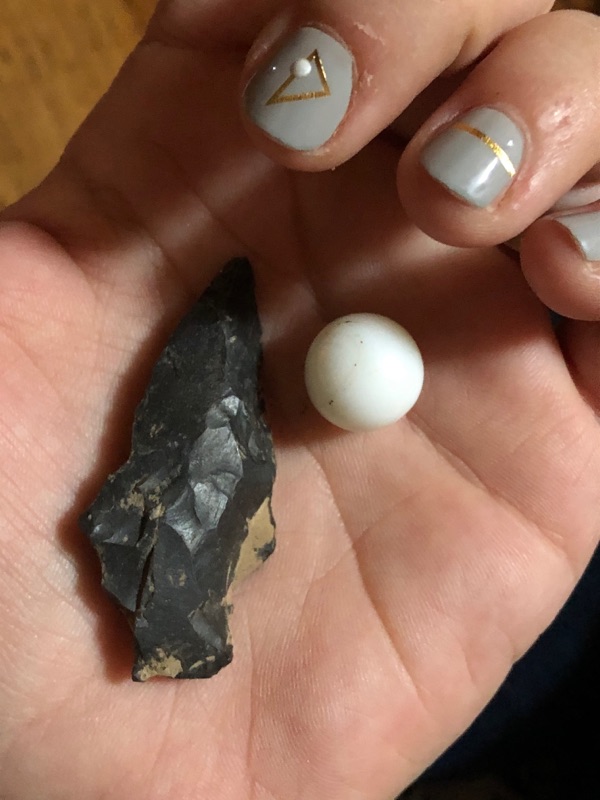
Black Spear Point- Olivier Site

​I'd spent a decade or more walking what used to be a mound, now plowed a few times a year, called the Olivier Site. I am friends with the daughter of the owner of this field, which rotates soybeans and sorghum. I monitor this field. It was a prehistoric stone working place at the very edge of the Teche escarpment. The first artifacts I found there were scores of knapping shards, still very fine and sharp after all these years. They were multicolored, and since rock doesn't exist naturally in this prairie delta the imagination wonders to the origins of the white, blue, black, grey and red stone chips. Finding each one was thrilling for me. 

I had been told that the neighbors found many artifacts in that field, but I never found more than the knapping pieces and maybe a small broken point or two. They are concentrated on the north edge of the rise of what used to be a great mound. 

One day in 2019 I was walking the field as usual. I had never found a full artifact before. I found a white marble that reminded me of the full moon and some knapping and ceramics when all of a sudden I saw a piece of bone in the soil. I don't know what kind of mound was here before, but its likely it was burial. I picked up the piece of broken bone and just held it, out there in the field. It was leg or arm. In that moment I heard in my head, "You're going to find a point." I walked three steps and there was the black spear point on the dirt. 


Monday, May 25, 2026

Meche-Wilkes Mound


The Meche-Wilkes Mound, is located near Arnaudville on the periphery of the Atchafalaya Basin on the edge of the Pleistocene terrace. This site has been protected by the landowner and is relatively undisturbed. Gibson conducted excavations at the Meche-Wilkes Mound in 1990. The site contains deposits dating to the Poverty Point, Tchefuncte, Baytown, Plaquemine, and historic periods (Lousiana State Site Form).


The Anthropology department came across an historical discovery in '89, revealing some history of Acadiana. Archaeological excavations at Meche-Wilkes mound near Grand Coteau by USL archaeology students confirmed the earthen mounds were built by the Acadiana's native people during the first pre-Christian millennium. These mounds were used for cooking during the era. Lonnie Utley USL's L'Acadien 1989

Sunday, May 24, 2026

On the Olivier Site and Meche-Wilkes Mound


Jon L Gibson 
The Ancient Mounds of Poverty Point Place


CULTURAL RESOURCES SURVEY OF FOUR DISPOSAL AREAS ALONG THE VERMILION RIVER LAFAYETTE PARISH, LOUISIANA

Cultural Resources Survey of Four Disposal Areas Along the Vermilion River Lafayette Parish


Cultural Resources Survey of Four Disposal Areas 
Along the Vermilion River Lafayette Parish:
US Army Corps of Engineers

"USL continued to excavate selected sites in the general area. A. Frank Servello conducted test excavations in the Meche-Wilkes Mound (16SL18) on Coulee de Marks between Grand Coteau and Arnaudville in the late 1970s. Coulee de Marks is a tributary of Bayou Fusilier, which is the eastern head branch of the Vermilion River. Gibson continued excavations there in 1989-1991. This site has a low conical mound filled with fragments of Poverty Point objects as well as fiber-tempered and untempered Tchefuncte-like pottery, surrounded by a midden containing untempered Tchefuncte-like pottery (Gibson 1990a:109-lll, 117-118, Tables 26-27). The fiber-tempered pottery is similar to that from the Ruth Canal site, 20km to the south, and these sites, along with a few others bearing fiber-tempered wares in the locality, probably represent a very narrow time interval around 1000 B.C."


"Despite its compact size, Beau Rivage (near the confluence of Bayou Tortue and Vermillion River) had large quantities of exotic rocks—thousands of pieces and possibly hundreds of kilograms. Exotics make up over a third of all lithic materials in the available collection (Gibson 1976a:Table 20). There are at least nine other sites within a 25km radius of Beau Rivage that have exotic materials—materials other than novaculite and quartz crystals, which are not really exclusive Poverty Point commodities (Gibson 1991b). The Olivier site (16SL12), near the junction of Coulee de Marks and Bayou Fusilier, is the most notable of these other sites (Gibson 1976a:38-39). But none of these sites comes close to matching Beau Rivage in absolute quantities, although Olivier might come close in terms of relative quantities. The point to be made here is that Beau Rivage is not an isolated component. For 25km above and below Beau Rivage along the Coteau Ridge and flanking Vermilion swamp are other presumably coeval sites bearing foreign lithic materials. We suspect Beau Rivage was the local supplier. But where did Beau Rivage get the rocks? In an earlier analysis, Gibson claimed that they came directly from the Poverty Point site, 280km to the north {Gibson 1979). Gibson thought they were first delivered to Poverty Point, where they were rendered into tool blanks before they were then shipped on to distant consumers, like Beau Rivage. Now, after more than a decade of recent excavation at Poverty Point have failed to find either the unaltered bulk materials or the primary chipping residue showing that preshaping actually took place at Poverty Point, we are not as certain. Initial shaping of tool blanks for trade now seems more likely to have been carried out at the rock outcrops or deposits themselves. Poverty Point still seems to be the most likely source of the blanks and nodules that got to Beau Rivage, but search for intervening distributors continues."


"...Several San Patrice points were found at Meche-Wilkes Mound, on Coulee de Marks near its junction with Bayou Fusilier"


"Additional Archaic components occur upstream and downstream from Lafayette. Downstream some eight kilometers below the Vermilion River gap is a cluster of sites (16VM7, 16VM17 and 16VM23) near the mouths of Anslem Coulee and Coulee He des Cannes. One of these (16VM23) produced several projectile points (including Evans, Ensor, Benton, and others), point fragments, drills and drill fragments, chipped adzes and gouges and fragments, boatstone fragments, and tubular and barrel-shaped stone beads (Gibson 1976a:Table 23, Figure 10). However, only a handful of flakes was recovered, totally insufficient to complement the number of finished tools on the site. The assemblage is unusual enough to lead us to suspect that it might be functionally specialized, perhaps even ceremonial. Upstream where the river parallels the Coteau Ridge are other Archaic components, and on the low Prairie des Femmes terrace, where flanked by Coulee de Marks between Grand Coteau and Arnaudville, is the oldest Archaic component known in the Vermilion locality. The Coulee de Marks site (16SL48) produced Early Archaic point types, Keithville and Cache River, as well as point fragments and preforms, small flake end scrapers, and chipping residue (Gibson 1990a:Table 24). There was substantial Archaic activity on or near the Vermilion River, and it seems to have spanned much of the long Archaic interval. But precisely when and what forms it took are unknown. We have only the most general perceptions of the interval, but they are sufficient to show that the locality continued to be a favorite spot for native groups. Having a long-standing sizeable population in a place with easy access to the interconnected waterways in the Lower Mississippi Valley was probably a prerequisite for entering into an era of commercial exchange, which characterized the ensuing period."


Back Field Habitation

This field where we settled over 20 years ago never seemed physically special but there was a presence here. It's a leached sweet potato field out in the center of the open prairie, near the oxbow woods as I called them. It was not on the bayou. There was no important earth works, inclines or mounds as there are in other places in the prairie. The neighbors have found buckets full of artifacts: spear points, grind stones and stone tools. I know of the three prehistoric sites in the prairie including the Meche-Wilkes Mound and the Olivier site, but they are a half mile away from here. For years I have walked looking at the ground and feeling the subtle undulations, but never suspecting that there had ever been anything here besides farmland and pasture. 

I had found ceramics. Years ago we surmised they were spread to aerate the soil for farming. Maybe they were spread in a flood event. Either seemed plausible. Maybe more plausible than there being a homestead in the exact spot that we chose, ten acres back off a gravel road, near haphazardly and only because of its proximity to a lone cypress in the tree line. 

I found delicate things in the earth though, the curl of a blue and white fleur de lis, doll arms and legs, pieces of plates, bricks, thick crocks and milk glass. Still, with our position back here I could hardly imagine there had been habitation so far off of the dirt road. There were no paths or racourcis that I knew of crossing the prairie. Still I got the message that there was memory back here, both recent and ancient. Then one day in the carrot patch I found a real rock in the shape of a perfect heart. 

In the east yard we plowed some rows to plant coton jaune, native brown cotton. After it rained I would inspect the exposed ground along the rows. I found another stone, but this time it seemed to be a hand tool for grinding or hitting. There was a worn tip and slight indentions along the sides that fit my thumb and fingers perfectly. I marveled at its weight and ergonomic feeling in my hand. 
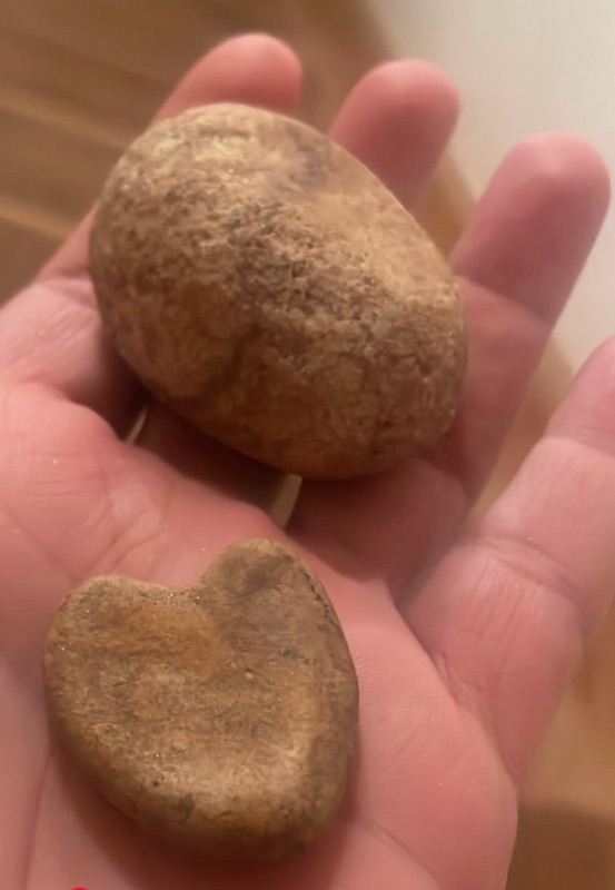

Sometimes when I walk the field, or even recently when I turned over a little dirt out there, I still find white ceramics and strange rocks, sometimes blue glass that looks knapped at the edges. The more I let the prairie grow, the more old plants appear that tell of use. The more I dig, the more is unearthed. I tell myself if there was a home place here it would have been in my east back field according to the evidence, but it still doesn't make sense. Not to mention how ironic it would be to have built in the same place. On the other hand, it does makes sense to me, because there is a tangible presence back here that is pleased to be remembered.

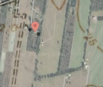
Recently I was going through some old topography maps online of the area and something caught my eye: a few black squares denoting domicile on the 1940 topographic map, far back in the prairie. Intrigued, I doubted it was far enough to be my field. But I used the overlay tool to match up the road and other landmarks with satellite maps, and discovered to my surprise that they were located at the end of my driveway, flanking both sides of my house, in the exact place where I find the ceramics in the backfield. 


Friday, June 13, 2014

Prairie des Femmes Origins

Had a good visit with my new little babysitter who lives across the prairie a half mile south as the crow flies. A beauty, she seemed to be a direct descendant of the very women the Prairie is named for. We swapped ghost stories and information about old sites and neighbors and talked about the Indian artifacts that are found here. When I asked her what was the story she had heard of the Prairie, she said her daddy said it was where the Indians "hid" their women when they went off hunting or fighting. It was the first time I'd heard it told like that, and I liked it!