

Showing posts with label pointe claire. Show all posts
Showing posts with label pointe claire. Show all posts
Sunday, July 12, 2026

Saturday, September 14, 2024
La Pointe Claire
General belief is that Pointe Claire was a clear, open grassland in the cove directly east and bordering la Prairie des Femmes. To arrive at the Pointe Claire from the Prairie des Femmes cross the Coulee des Marks at Marks Bridge, and travel north on Jules LaGrange until it intersects Hwy 347. To the west one will intersect Leonville and the Bayou Têche, and to the east toward Arnaudville is la Pointe Claire.
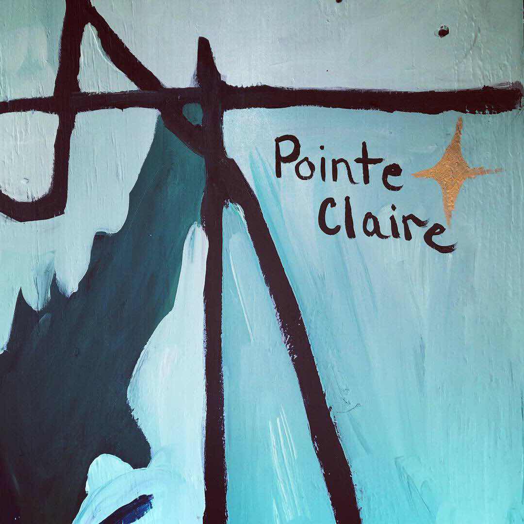 |
| Prairie des Femmes generator box by Churchgoing Mule |
According to Mike Leblanc, who has a wonderfully informative blog linked below:
Saturday, September 7, 2024
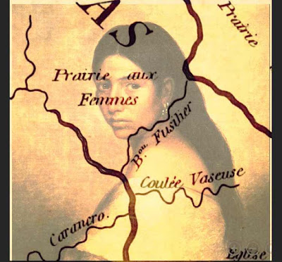
Our Lady is not Bound by Means: The Borders of Prairie des Femmes
Prairie des Femmes is a small prairie found near the border of the Ishak and Oplousas territory, one of the earliest places found and settled within the colonial Poste des Opelousas. My research of this place has spanned 20 years and continues to grow in profondeur. Prairie des Femmes is a translation of the original Ishak, possibly Choctaw name. In keeping with this momentum, my goal is to find the indigenous name for this land. The possible approximation provided to me by Attakapas-Ishak scholar and poet Jeffery Darensbourg is Lōksh Keshíke, Prairie Women, in Ishak, but we can not know if the French that remains is a true translation of what was originally here, or their interpretation of what they found.
Our Lady is not bound by means but if we must give boundaries she is found at the triangulation of the villages of Grand Coteau to the west, Arnaudville to the east, and Leonville to the north. The historic community of Frozard (Olivier Plantation) is found within the southern boundary of Prairie des Femmes, at an intersection of the old native path we now call Hwy. 93 and Meche-Frozard roads, and extends south to the junction of Bayous Fuselier and Bourbeux. I often say that if Prairie des Femmes had a city or crossroads, it would be Frozard.
PDF is water-bound by an oxbow swamp to the north, Bayou Fuselier to the southeast, Bayou Bourbeaux to the north and west. There are at least two bridges in the interior prairie, one over the Bourbeaux at Hickory and one over La Coulee des Marks known as Marks Bridge at Jules LaGrange.
She is a prairillon among other larger prairies of Louisiana. To the north, in the back, and across the oxbow swamp is the native-Creole enclave of Prairie Laurent, also known as la Côte/l'anse des Mulates. To the northwest, la Prairie des Coteaux where Cypress Valley can be seen east of I49 at Opelousas. To the west of Prairie des Femmes is la Prairie des Grands Coteaux, and to the east, la Pointe Claire and la Prairie des Gros Chevreuils which touches the western levees of the Atchafalaya basin and encompasses Pecaniere. To the south is la Prairie Basse, aka Prairie de Manne (colonially Prairie de la Grosse Patate), with the greater Prairie Carencro further south.
Prairie des Femmes exists in an area congruent with the boundaries of the Attakapas-Ishak tribal lands and the Opelousas tribal lands and there is much evidence of earthworks, mounds, pottery, grindstones and spear points found here. There are pre-historic mound sites that connect to Poverty Point. Despite years of modern agriculture on the prairie, these features, as well as land-memory, persist and continue to reveal themselves.
Sunday, February 25, 2024
Tuesday, May 5, 2020
Prairie des Femmes and other Locales
Via Mike Leblanc:
10.0 Adjacent Angles, Prairies and Points
There is yet other places, known as Prairie Laurent, Prairie des Femme, and Point Clair. Each has its distinctive character based on the stories upon which its sense of place was created.
10.1 Prairie Laurant
Prairie Laurant is also known as Prairie des Mulates, that is literally, Prairie of Mulattoes. Mulatto is in French, is called a mulâtre for men and mulâtresse for women.[1] Perhaps one of the most well known residents of La Prairie Basse is Clifton Chenier, and his brother, Cleveland, both proud black men, who are among the founders of Zydeco music. Reflecting their racial heterogeneity, their music is a hybridization of Blues, Jazz, Cajun, Country and Western, and Rhythm and Blues, played with an accordion, that quintessential French instrument, and a washboard, a folk instrument used to create African rhythms.
10.2 Prairie des Femmes
To south of Prairie Laurent, a place is still called La Prairie des Femmes (or literally Prairie of Women). If you ask an inhabitant of that place (who are mostly Cajuns) what is the origin of that place name, you will be told that all of the men were killed while on a hunting expedition in time long forgotten or during a war, particularly World War I or World War II. However, the earliest maps of the area created by Spanish indicate that the place was called the same name so the meaning has been placed mouth to ear for some 300 years, its true meaning lost to the ghosts of another time.
To the east of La Prairie des Femmes is a place called Pointe Claire, a pasture used in the spring to herd cattle upon the grasslands. As late as the 1960’s, the cattle were driven by horseback from land laid fallow in the winter months to these nearby pastures for their spring grass. These lands were first discovered by that early band of Africans who hunted deer to extinction and were later to inter-marry with Acadians who herded cattle upon those lands.
10.3 McVeigh Plantation
To the south of La Prairie Basse lies the McVeigh plantation, a place of level lands upon a prairie cleared of its high grass and where slavery was practiced in the 19th Century and later where share cropping also enslaved Afro-American, Creoles and Cajuns in a labor system meant to drive their laborers and their families into penury and serfdom meant to tie them to land as well as to enrich their land owners. Today, McVeigh Road runs down the middle of this plantation and is bordered on both sides by cane fields.
McVeigh Road comes to an end at its intersection with Louisiana Highway 31, which parallels Bayou Teche. Alongside of highway is a narrow strip of land upon, which was too narrow to farm and which was the location of the sharecropper shacks used in the early 20th Century. While the descendants of Ton Ton were free persons of color and devote Catholics, the descendants of the slaves working on the McVeigh plantation were lively Protestants, practicing within the Baptist Convention.
Information via Mike Leblanc
Friday, July 15, 2016

Sunday, April 12, 2015


Tuesday, September 16, 2014

Tuesday, August 26, 2014
Dans la Prairie des Femmes
Dans la Prairie des Femmes
Les oiseaux chantent tout le temps
Même ils chantent
au milieu de la nuit
Dans la Prairie des Femmes
Les guêpes et les serpents
Et dans l'été
Ca tombe les jambes de pluie
La Prairie des Femmes
Pointe Claire
Prairie Laurent
Les femmes restait
Les femmes restait
les hommes sont partis
Dans la Prairie des Femmes
Je crois je peux attendre
Je crois je peux attendre
Quand dans la silence j'entends
dans la nuit

Sunday, June 15, 2014
Complexes of Apartment

 |
| Rue Royale on Pont des Mouton |

 |
| La Petite Place Apartments in Grand Coteau |
 |
| Pointe Claire Plaza on the Pointe Claire side of Arnaudville |
 |
| La Belle Maison in Kenner |
 |
| La Bonne Vie in Lafayette |
Saturday, July 6, 2013


Monday, June 17, 2013


Thursday, June 13, 2013
Green Pears in Leonville
On the way, there is my favorite little homestead: it is a little white house with a blue roof and red truck in the driveway. It is surrounded by the green fields along Jules LaGrange. In the ditch are a big clump of red flowering ginger and in the side yard are hand painted statues of Jesus and Mary. Their house reminds me of the cardinals that swoop across the road along the bayou:
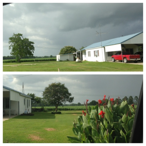
The town of Leonville itself is a little like a 1940's ghost town. A few hundred people live in quiet, neat houses and trailers, and otherwise, abandoned white structures line the streets. Even the brown Teche flows quietly through with none of the fanfare you would find over it in a place like Arnaudville. At the heart of Leonville is Champagne's grocery, flanked by Leonville Elementary on one side and the rounded bell tower of St. Leo's Church on the other. Inside I recognized a few of my old students and their growing siblings. I am always greeted with a "Bonjour Madame", even though I only taught French at the high school for five years and haven't taught in three.
D'après moi, Champagnes' Marche' is the perfect local grocery store. They had home-grown cantaloupes, perfectly portioned packs of green beans, soft loaves of sausage-jalapeno-cheese bread and giant boxes of Little Debbie Snacks. I got a six-pack of glass bottle cokes. I especially enjoyed picking out four green pears, whose green color and form seemed to belong in some mystical way to the very fiber of grey Leonville.
In the parking lot, I saw a plainclothes Father Ken Domingue walk in, red shirt, smiling. He had taught me as a teenager at Sacred Heart in Ville Platte. Other people were pumping gas. There were dark, thin men with their sons, blonde mothers with children, more of my students, and an old couple talking in French. The church bells gonged the half hour. People were going home.
Near the silos at Mark's Bridge, Mister Simon, expert snake killer and father to les belles filles Stelly was crossing the road near his lovely oak-shaded home on the Coulee. I pulled over briefly to tell him Hey, I almost called you earlier! I had a six foot chicken snake in my cabanne! He laughed. I told him that it got away, and I wanted to use my pistol, but there was cement in the cabanne, and would it ricochet? As I saw a black truck coming up behind me from the fields, Mister Simon said, Oh no, you don't wanna do dat, it'll ricochet bad! and as I drove away, he waved and laughed, Don't do dat!!
 |
| Mista Simon, masta snake killa and awesome neighbor! Pic by M. Stelly |
Further up the road, where the new houses (!) are being built, there was my old student the PDF Gazette and another neighbor, Tante Claire, visiting in the yard. I took the chance to pull over, visit for a minute, en Francais meme! and take a couple pictures of the double (triple) Mary Statues in their yard. It was nice to get to talk to the neighbors. I even saw something at their place that I never saw before:
 |
| A cement baby Jesus- SHA!!!!! |
 |
| Prairie Pietà |
 |
| Appropriate Double-Grotto Home In the Prairie of the Women |
 |
| Our Lady, Reine des Guêpes (and there are many on the Prairie!) |
 |
| You never know the mystical things you will see when you go to Leonville... |
Friday, May 10, 2013
The Mistic Marie of Pointe Claire
Monsieur Mistic's Mary in Pointe Claire used to be lit up by a blue light at night. Their neighbor still lights theirs up like THIS. Here is what he said happened to his statue after his "old mama" passed away:


Sunday, August 5, 2012
La Prairie des Femmes

La Prairie des Femmes (Women's Prairie) is a pre-colonial prairie name, located in Saint Landry Parish, Louisiana that borders an oxbow-shaped swamp to the north, Bayou Bourbeau to the west, and Pointe Claire to the east. Prairie Laurent is to the north/northwest and la Prairie Basse to the south. The nearest town is Leonville, and the towns of Arnaudville (La Jonction) and historic Grand Coteau are nearby. Coulée des Marks runs through la Prairie des Femmes and creates a cypress basin at the country intersection of Thomassee and Jules Lagrange roads at Pont des Marks, or Mark's Bridge.
Prairie des Femmes appears on detailed maps of the region as early as 1806, having been inhabited by French Creoles well before this time. The prairie was at the border of the Atakapas and Opelousa tribe's territories, so there was much Indian traffic through the area. Legend has that the area was a high land, a safe zone near the bayous where Native American women lived together while the men hunted or warred with neighboring tribes. Another story says that in Louisiana's historic flood of 1927 that woman and children were sent there from neighboring communities because of its safety. Another tale sites the area as a place where the widows of the soldiers of the Civil War settled to live the remainder of their lives in peace. The most likely story of the origin of the name Prairie des Femmes has two versions: One is that the natives inhabiting the prairie moved after a hunt, as was custom. A few of their old women were left at the camp being too old to move. The other version is similar, but is more mysterious: that the braves went off one day on a hunt leaving the women and children and simply never came back. The women left there were discovered by the French Creoles and Acadians who settled the area who called it La Prairie des Femmes.

Subscribe to:
Posts
(
Atom
)